Research Highlights
Identification of significant locations of Road and Rail Infrastructure in Chicago metropolitan area facing floods
September 04, 2025

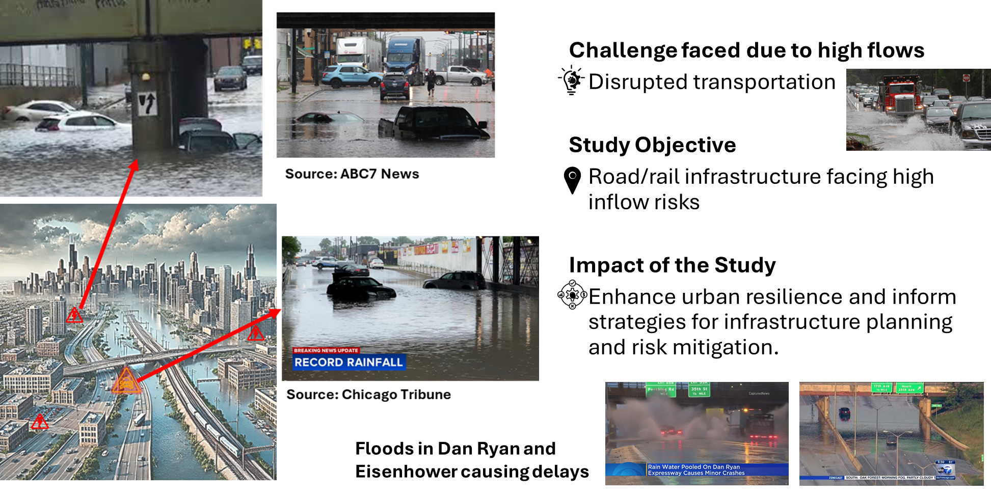
The Science Objective
Find critical flood-prone locations within the Chicago metropolitan area to develop an optimization algorithm for providing the safest and most efficient transportation routes, minimizing flood risk during extreme weather events.
Approach
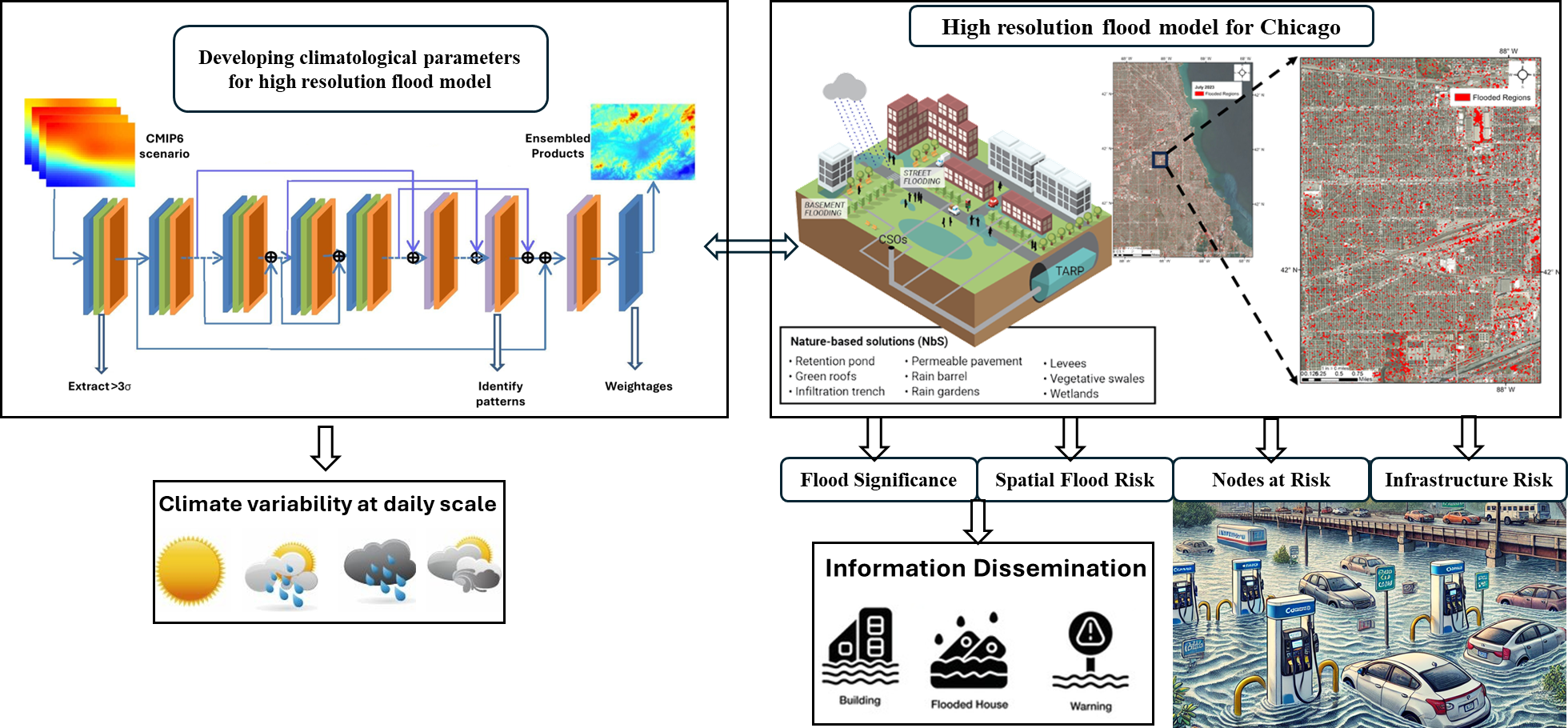
- The approach begins by collecting and preprocessing diverse datasets, including historical flood events, real-time crowdsourced data, precipitation patterns, SAR interferometry, and Landsat-derived NDVI for the Chicago metropolitan area.
- The datasets are further harmonized to create a comprehensive flood risk dataset.
- SWMM-HEC-RAS model is then employed to simulate flood events, modeling hydrological and hydraulic processes such as rainfall, runoff, and flood depth.
- Critical flood-prone areas are identified and scored based on flood risk, with a focus on transportation infrastructure vulnerability.
- An optimization algorithm is developed to determine the safest and most efficient transportation routes by incorporating flood risk data, ensuring resilience during extreme weather events.

Impact
-
This study will significantly improve the accuracy of flood risk prediction in urban environments by integrating real-time crowdsourced data with historical flood information and advanced hydrological modeling.
-
The optimized transportation routes derived from the flood-prone location analysis will enhance the resilience of the Chicago metropolitan transportation network, ensuring the safety and efficiency of critical infrastructure during extreme weather events.
-
By involving local communities in the data validation process, the study empowers residents to actively contribute to flood risk management, fostering greater community engagement.
-
This will aid decision-makers with more reliable, data-driven insights for flood mitigation and urban planning.
-
This approach not only strengthens urban resilience to floods but also offers a scalable model that can be applied to other flood-prone regions globally to reduce economic losses and improving public safety during flood events.
Summary
This study integrates historical flood data, crowdsourced validation, and hydrological simulations to identify critical flood-prone locations in the Chicago metropolitan area. An optimization algorithm will then determine the safest transportation routes, minimizing flood risk during extreme weather events. The approach aims to enhance urban resilience, improve transportation safety, and provide scalable solutions for flood management in other regions.
Team Members

Abhinav Wadhwa (Postdoc)
DPI

Wencheng Bao (Student)
UIUC

Eleftheria Kontou (Advisor)
UIUC

Ashish Sharma (Advisor)
DPI
Publications
A Wadhwa, W Bao, E Kontou, A Sharma, C Chen, “Identification of Significant Locations of Road and Rail Infrastructure in Chicago Metropolitan Area Facing High Inflows”, 105th Annual AMS Meeting 2025
Sign up for our mailing list
You’ll receive the latest updates on CLEETS research and programming.
